Category:SVG labeled maps of administrative divisions of Suriname (location map scheme)


.svg)


_(Paris_zoom).svg)
.svg)
,_administrative_divisions_-_de_-_colored_(multizoom).svg)
_-_colored.svg)
.svg)
,_administrative_divisions_-_Nmbrs_(multizoom).svg)
,_administrative_divisions_-_de_-_colored.svg)
_-_de_-_colored.svg)

.svg)

.svg)
Media in category "SVG labeled maps of administrative divisions of Suriname (location map scheme)"
The following 8 files are in this category, out of 8 total.
-
 Suriname administrative divisions - ukr - colored.svg 512 × 522; 246 KB
-
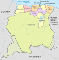 Suriname, administrative divisions - de - colored.svg 1,181 × 1,205; 378 KB
-
 Suriname, administrative divisions - de - monochrome.svg 1,181 × 1,205; 378 KB
-
 Suriname, administrative divisions - et - colored.svg 1,181 × 1,205; 286 KB
-
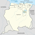
 Suriname, administrative divisions - Nmbrs - colored.svg 1,181 × 1,205; 384 KB
-
 Suriname, administrative divisions - Nmbrs - monochrome.svg 1,181 × 1,205; 384 KB
-
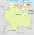
 Suriname, administrative divisions - ru - colored.svg 1,181 × 1,205; 529 KB
-
 Suriname, administrative divisions - th - colored.svg 1,181 × 1,205; 408 KB


