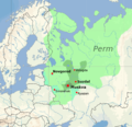
ملف:Muscovy 1390 1525.png
المظهر
Muscovy_1390_1525.png (440 × 425 بكسل حجم الفايل: 135 كيلوبايت، نوع MIME: image/png)
تاريخ الفايل
اضغط على الساعه/التاريخ علشان تشوف الفايل زى ما كان فى الوقت ده.
| الساعه / التاريخ | صورة صغيرة | ابعاد | يوزر | تعليق | |
|---|---|---|---|---|---|
| دلوقتي | 16:20، 23 يناير 2022 |  | 440 × 425 (135 كيلوبايت) | Ориенталист | Reverted to version as of 16:40, 5 October 2020 (UTC) See File:Russo–Lithuanian Wars-1500 campaign-rus0.2.svg This territories became part of Russia during Ivan III |
| 10:09، 2 ديسمبر 2021 |  | 440 × 425 (170 كيلوبايت) | Dbachmann | Reverted to version as of 13:12, 17 April 2011 (UTC) -- I am sorry, please explain the change, you cannot just say "more accurate" without changing the references to the sources this is based on. | |
| 16:40، 5 اكتوبر 2020 |  | 440 × 425 (135 كيلوبايت) | Ориенталист | More accurate | |
| 13:12، 17 ابريل 2011 |  | 440 × 425 (170 كيلوبايت) | Dbachmann | update | |
| 12:42، 17 ابريل 2011 |  | 450 × 438 (212 كيلوبايت) | Dbachmann | {{Information |Description ={{en|1=Grand Duchy of Moscow (Muscovy) between 1390 and 1547}} |Source =blank map: File:Europe location POR.png |Author =Dbachmann |Date =2011 |Permission = {{Copyrighted free use provided |
استخدام الفايل
ال1 صفحة دى فيها وصله للفايل ده:
استخدام الملف العام
الويكيات التانيه دى بتستخدم الفايل ده:
- الاستخدام ف af.wikipedia.org
- الاستخدام ف ast.wikipedia.org
- الاستخدام ف ba.wikipedia.org
- الاستخدام ف be-tarask.wikipedia.org
- الاستخدام ف be.wikipedia.org
- الاستخدام ف bn.wikipedia.org
- الاستخدام ف bn.wikibooks.org
- الاستخدام ف ca.wikipedia.org
- الاستخدام ف ce.wikipedia.org
- الاستخدام ف cs.wikipedia.org
- الاستخدام ف cy.wikipedia.org
- الاستخدام ف da.wikipedia.org
- الاستخدام ف de.wikipedia.org
- الاستخدام ف el.wikipedia.org
- الاستخدام ف en.wikipedia.org
- الاستخدام ف en.wikibooks.org
- الاستخدام ف en.wiktionary.org
- الاستخدام ف eo.wikipedia.org
- الاستخدام ف es.wikipedia.org
- الاستخدام ف et.wikipedia.org
- الاستخدام ف eu.wikipedia.org
- الاستخدام ف fa.wikipedia.org
- الاستخدام ف fi.wikipedia.org
اعرض استخدام عام اكتر للملف ده.


