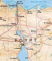
Fayl:Sinai-peninsula-map.jpg
Naviqasiyaya keç
Axtarışa keç

Sınaq göstərişi ölçüsü: 483 × 600 piksel. Digər ölçülər: 193 × 240 piksel | 387 × 480 piksel | 941 × 1.168 piksel.
Faylın orijinalı (941 × 1.168 piksel, fayl həcmi: 665 KB, MIME növü: image/jpeg)
Faylın tarixçəsi
Faylın əvvəlki versiyasını görmək üçün gün/tarix bölməsindəki tarixlərə klikləyin.
| Tarix/Vaxt | Miniatür | Ölçülər | İstifadəçi | Şərh | |
|---|---|---|---|---|---|
| hal-hazırkı | 20:45, 12 may 2011 |  | 941 × 1.168 (665 KB) | Ras67 | cropped |
| 22:58, 4 mart 2007 |  | 956 × 1.196 (307 KB) | Joao Xavier | Map of the Sinai Peninsula. (U.S. Central Intelligence Agency, https://www.cia.gov/cia/publications/mapspub/index.shtml) originally found on University of Texas library website (http://www.lib.utexas.edu/maps/middle_east_and_asia/sinai.jpg) and claimed as |
Faylın istifadəsi
Aşağıdakı səhifə bu faylı istifadə edir:
Faylın qlobal istifadəsi
Bu fayl aşağıdakı vikilərdə istifadə olunur:
- af.wikipedia.org layihəsində istifadəsi
- als.wikipedia.org layihəsində istifadəsi
- ar.wikipedia.org layihəsində istifadəsi
- ast.wikipedia.org layihəsində istifadəsi
- azb.wikipedia.org layihəsində istifadəsi
- az.wiktionary.org layihəsində istifadəsi
- ba.wikipedia.org layihəsində istifadəsi
- bn.wikipedia.org layihəsində istifadəsi
- bs.wikipedia.org layihəsində istifadəsi
- ca.wikipedia.org layihəsində istifadəsi
- cs.wikipedia.org layihəsində istifadəsi
- da.wikipedia.org layihəsində istifadəsi
- de.wikipedia.org layihəsində istifadəsi
- de.wikinews.org layihəsində istifadəsi
- de.wiktionary.org layihəsində istifadəsi
- diq.wikipedia.org layihəsində istifadəsi
- el.wikipedia.org layihəsində istifadəsi
- el.wiktionary.org layihəsində istifadəsi
- en.wikipedia.org layihəsində istifadəsi
- eo.wikipedia.org layihəsində istifadəsi
- es.wikipedia.org layihəsində istifadəsi
- eu.wikipedia.org layihəsində istifadəsi
Bu faylın qlobal istifadəsinə baxın.


