Category:Old maps of Israel
Jump to navigation
Jump to search
Old maps of Israel — in the Near East of Western Asia.
Use the appropriate category for maps showing all or a large part of Israel. See subcategories for smaller areas:
| If the map shows | Category to use |
|---|---|
| Israel on a recently created map | Category:Maps of Israel or its subcategories |
| Israel on a map created more than 70 years ago | Category:Old maps of Israel or its subcategories |
| the history of Israel on a recently created map | Category:Maps of the history of Israel or its subcategories |
| the history of Israel on a map created more than 70 years ago | Category:Old maps of the history of Israel or its subcategories |

Subcategories
This category has the following 17 subcategories, out of 17 total.
B
- Old maps of Bnei Brak (7 F)
D
E
G
H
J
M
- Maps of the Kingdom of Israel (56 F)
O
S
- Old maps of the Sea of Galilee (38 F)
Media in category "Old maps of Israel"
The following 147 files are in this category, out of 147 total.
-
 Land of Israel by Rabbi Chaim Salomon Pinta of Zefat.1875.jpg 800 × 600; 735 KB
-
 Hadera map sketch.jpg 747 × 569; 138 KB
-
 A dictionary of the Bible.. (1887) (14595190740).jpg 2,032 × 3,288; 990 KB
-
 A Plan of Rehovot.jpg 2,515 × 2,147; 1.57 MB
-

-
 Al Auja.jpg 2,764 × 1,737; 9.76 MB
-
 Al-Nabi Yusha'.jpg 563 × 523; 185 KB
-
 An-Far.jpg 1,170 × 604; 1.32 MB
-
 Brockhaus and Efron Encyclopedic Dictionary b44 625-0.jpg 2,552 × 3,379; 2.62 MB
-
 Brockhaus and Efron Jewish Encyclopedia e12 199-0.jpg 1,789 × 2,618; 1.54 MB
-
 Brockhaus and Efron Jewish Encyclopedia e12 227-0.jpg 1,099 × 1,520; 302 KB
-
 Brockhaus and Efron Jewish Encyclopedia e12 229-0.jpg 1,105 × 1,502; 299 KB
-
 Brockhaus and Efron Jewish Encyclopedia e12 247-2.jpg 1,123 × 1,587; 386 KB
-
 Brockhaus and Efron Jewish Encyclopedia e3 865-0.jpg 445 × 637; 109 KB
-
 Brockhaus and Efron Jewish Encyclopedia e9 667-0.jpg 652 × 1,067; 134 KB
-
 Canaan (Spruner-Menke, Atlas Antiquus, 1865).jpg 6,698 × 5,448; 27.02 MB
-
 Conrad Buno00a. The Geographer.jpg 2,222 × 400; 335 KB
-
 DCawm4-1-64-7Ap6sk.jpeg 1,746 × 1,083; 346 KB
-
 DCawm4-1-64-7Ap6skM.jpeg 1,812 × 1,354; 455 KB
-
 Die Sieben Säulen der Weisheit, Skizze II.jpg 904 × 1,172; 225 KB
-
 Die Sieben Säulen der Weisheit, Skizze IV.jpg 861 × 1,255; 260 KB
-
 Diunot zal.jpg 656 × 1,008; 171 KB
-
 Edmond Halley, De Bergh Carmel (FL6882390 2476033).jpg 3,106 × 2,000; 3.44 MB
-
 Edmond Halley, De Bergh Thabor (FL6879701 2476167).jpg 3,076 × 2,000; 4.05 MB
-
 Edmond Halley, De Olyf Berg (FL6880687 2476195).jpg 3,100 × 2,011; 3.36 MB
-
 Edmond Halley, Joppe (FL6880171 2476100).jpg 3,109 × 2,010; 3.72 MB
-
 Environs de Ptolémaïs ou d'Acre pour l'Histoire de Saladin. par le Sr d'Anville.jpg 2,152 × 2,018; 880 KB
-
 Falls Map 21det.jpeg 2,408 × 3,446; 1.4 MB
-
 Falls sketch 12.jpeg 683 × 1,050; 239 KB
-
 Falls sketch 14.jpeg 662 × 1,041; 236 KB
-
 Falls sketch 15.jpeg 650 × 1,004; 284 KB
-
 Falls sketch 16.jpeg 1,470 × 1,004; 541 KB
-
 Falls sketch 24.jpeg 1,437 × 1,100; 598 KB
-
 Falls sketch24 det 1.jpeg 1,196 × 2,321; 800 KB
-
 Falls skMap20 PassageNahr Auja.jpeg 1,354 × 2,088; 673 KB
-
 Falls skMap31Megiddo.jpeg 1,471 × 1,762; 636 KB
-
 Falls skMap32Megiddo.jpeg 1,429 × 1,758; 580 KB
-
 Falls2Map1SthPalDetMegiddo.jpeg 2,521 × 2,012; 1.2 MB
-
 Gottlieb Schumacher. Karte des Ostjordanlandes Blatt I. 1900.jpg 1,024 × 1,200; 249 KB
-
 Greater Jerusalem, May 2006. LOC 2006458043.jpg 8,264 × 10,696; 11.45 MB
-
 Greater Jerusalem, May 2006. LOC 2006458043.tif 8,264 × 10,696; 252.89 MB
-
 Grimm, J.L. Mahlmann, H. Tiberias. 1850-2.jpg 7,771 × 5,661; 8.84 MB
-
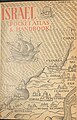 Herrmann M. Z. Meyer Israel 1961 cover.jpg 1,181 × 1,847; 512 KB
-
 Historische Karte von der Umgebung Jerusalem MK1888.png 369 × 580; 59 KB
-
 HOLY LAND Gerard de Jode. Speculum Orbis Terrarum.jpg 800 × 588; 269 KB
-
 Hug Haarech.JPG 1,230 × 755; 158 KB
-
 Hurlbut's Life of Christ for young and old (1915) (14586247508).jpg 1,558 × 2,394; 384 KB
-
 Image from page 230 of "A dictionary of the Bible.." (1887) (14595154277).jpg 1,848 × 1,228; 323 KB
-

-
 Israel Batch 1 (114).JPG 3,648 × 2,736; 3.92 MB
-
 IsraelMapByRabbiJosephSchwarzAt1847.JPG 3,392 × 5,780; 3.25 MB
-
 Israerail24.jpg 550 × 1,024; 144 KB
-
 Jaffa 1587.jpg 1,886 × 2,199; 1.57 MB
-
 Jean Baptiste Bourguignon d'Anville. La Palestine. 1767.jpg 8,904 × 7,695; 9.98 MB
-
 Jean Baptiste Bourguignon d'Anville. La Palestine. 1767.Positions.jpg 1,562 × 2,438; 661 KB
-

-

-

-
 Joseph Romain Joly. Carte de la Palestine depuis la captivité de Babylone. 1784.jpg 2,964 × 4,135; 8.36 MB
-
 Judea3.jpg 1,308 × 1,506; 479 KB
-
 Karl Baedeker. Akka & Umgebung (1910) (14766736185).jpg 1,245 × 1,279; 408 KB
-
 Karm&elBuqqarDet.jpeg 692 × 1,746; 279 KB
-
 Karte des Ostjordanlandes.jpg 22,772 × 20,864; 364.37 MB
-
 La Palestine, les tribus, et Jerusalem. LOC 99446187.jpg 6,746 × 5,357; 6.48 MB
-
 La Palestine, les tribus, et Jerusalem. LOC 99446187.tif 6,746 × 5,357; 103.39 MB
-
 La Palestine, pour l'Histoire des empereurs romains de M. Crévier. 1750.jpg 4,792 × 5,949; 4.48 MB
-
-
 The lands of the Saracen (IA landsofsaracen00tayl 0) (page 11 crop).jpg 1,679 × 2,505; 348 KB
-
 Large-scale-detailed-old-map-of-palestine-during-the-monarchy-1895.jpg 7,020 × 10,030; 27.44 MB
-

-
 Map of the Jerusalem Sanjak.jpg 571 × 1,006; 95 KB
-
 Map of the River Jordan and Dead Sea by W. F. Lynch.png 1,024 × 1,954; 2.98 MB
-
 Map of The River Jordan. 1871.jpg 1,679 × 2,734; 1.09 MB
-
 Maps 57 palestine megiddo (1600).jpg 1,600 × 1,232; 270 KB
-
 Mataheh.jpg 376 × 357; 289 KB
-
 Maury Geography 122D Palestine.jpg 484 × 798; 92 KB
-
 Medieval Arab Palestine.jpg 824 × 1,064; 191 KB
-
 Mishmar HaEmek i.jpg 893 × 405; 629 KB
-
 Mosaic Sail Tower.jpg 1,024 × 769; 404 KB
-
 Moshe Ganbash - Shiviti - Google Art Project.jpg 4,121 × 3,338; 7.68 MB
-
 Nr. 5. Acht Karten zur Geschichte Palaestinas.png 4,220 × 3,308; 39.97 MB
-
 Oldest surviving Ptolemaic map of Palestine, from Ptolemy's fourth map of Asia.png 1,313 × 836; 1.89 MB
-
 Operation Dekel.jpg 1,148 × 1,007; 2.33 MB
-
 Operation Hametz.jpg 733 × 378; 558 KB
-
 Operation Hiram.jpg 1,315 × 1,223; 2.76 MB
-
 Operation Nachshon i.jpg 1,062 × 539; 1.24 MB
-
 Operation Nachshon.jpg 1,453 × 645; 1.85 MB
-
 Operation Yiftach.jpg 597 × 1,094; 1.28 MB
-
 Operation Yoav iii.jpg 1,775 × 2,130; 6.33 MB
-
 Palestine according to Eusbius and Jerome - Smith 1915.jpg 2,416 × 3,987; 5.55 MB
-
 Palestine Arab Refugee Office map, showing Jewish-owned Land 31 March 1945.jpg 5,784 × 8,344; 11.53 MB
-

-

-
 Palestine Map in Gujarati - Jesus Period.png 472 × 684; 198 KB
-
 Palestine under the Maccabees Smith 1915.jpg 2,444 × 3,886; 6.03 MB
-
 Palestine under the Persians Smith 1915.jpg 2,155 × 3,460; 1.49 MB
-
 Palestine, Ptolemy, Claude R Conder, 1889.jpg 824 × 817; 126 KB
-
 Palestine-WW1-3-HE.jpg 588 × 848; 141 KB
-
 Palestine. LOC 98687122.jpg 5,784 × 8,344; 5.87 MB
-
 Palestine. LOC 98687122.tif 5,784 × 8,344; 138.08 MB
-
 Pauly-Wissowa II,1, 0360 b.jpg 749 × 914; 87 KB
-

-
 Plan of Sussita by Gottlieb Schumacher 1885.jpg 1,947 × 2,037; 1.52 MB
-
 Poleg.jpg 412 × 163; 16 KB
-
 Powles pp.160-1 16.11.17.jpg 2,265 × 2,814; 3.16 MB
-
 Powles pp.48-9 Magdhaba.jpg 2,572 × 2,144; 2.12 MB
-
 Ptolémaïde ou Acre. Jean Baptiste Bourguignon d'Anville. 18th century.jpg 1,120 × 1,300; 194 KB
-
 Ramma (Ramla) 1587.jpg 2,016 × 2,688; 1,019 KB
-
 Ramma (Ramla) 1657.jpg 2,472 × 1,517; 1.47 MB
-
 Routes et Villes de la Palestine. 1905-1905.jpg 1,870 × 2,365; 1.34 MB
-
 Sacred geography, and antiquities (1872) (14768851981).jpg 2,264 × 3,068; 740 KB
-
 Sacred geography, and antiquities (1872) (14769667914).jpg 2,136 × 3,536; 1.1 MB
-
 Sacred geography, and antiquities (1872) (14771693882).jpg 2,272 × 3,548; 965 KB
-
 Samaria, George Adam Smith.jpg 2,165 × 1,587; 1.18 MB
-
 Sarahanu el 'Amar cropped.jpg 5,935 × 2,932; 5.28 MB
-
 Sea of Galilee. A map of Canaan (8343807206) (cropped).jpg 662 × 848; 707 KB
-
 Shepherd-c-006-007.jpg 1,541 × 1,917; 827 KB
-
 Shepherd-c-024.jpg 984 × 1,544; 321 KB
-

-
 SofE7-22.1.17 697ZGaBee.jpeg 3,467 × 2,521; 1.93 MB
-
 Stieler, Adolf. Das Mittellandische Meer Und Nord-Afrika. 1875 BC.jpg 920 × 987; 251 KB
-
 Stieler, Adolf. Das Mittellandische Meer Und Nord-Afrika. 1875 BD.jpg 920 × 987; 257 KB
-
 Stielers Handatlas 1891 58.jpg 5,050 × 4,300; 6.87 MB
-
 Tabula moderna Terræ Sanctæ. RRA 3= 72. Pièce 49.jpg 2,304 × 1,790; 800 KB
-
 Tell Abu Hawam Plan 1932 (cropped).jpg 1,374 × 1,202; 495 KB
-
 Terra Canaan 1.jpg 1,400 × 2,919; 5.22 MB
-

-
-

-

-
 The Holman new self-pronouncing Sunday-school teachers Bible (1895) (14586876538).jpg 2,528 × 3,984; 1.36 MB
-
 The journeys, and deeds of Jesus, and scriptoral index on a new map of Palestine LOC 2009579464.jpg 8,975 × 12,631; 14.06 MB
-

-

-

-
 Toussaint, A. Carte de la Palestine. 1834.jpg 8,590 × 5,987; 7.18 MB
-
 Tribes of Israel 1658.jpg 2,483 × 1,995; 2.13 MB
-
 Tribus Aser.jpg 2,809 × 1,740; 1.99 MB
-
 Tribus des Juifs et Peuples avoisinants. 1905-1905.jpg 1,864 × 2,385; 1.06 MB
-
 Tribus Simeon 1658.jpg 2,487 × 1,896; 2.23 MB
-

-
 WoodheadMapB.png 1,000 × 1,485; 162 KB
-
 Березкин Д.М. Библейский атлас. (1911). — Палестина во время земной жизни Иисуса Христа.jpg 1,623 × 2,200; 1.81 MB
-
 Палестина (БЭАН).png 2,567 × 4,165; 248 KB
-
 אזור ואדי חנין במפת ז'אקוטן 1799.jpg 960 × 720; 120 KB
-
 חיספין במפה של גוטליב שומאכר מ-1885.jpg 461 × 405; 70 KB
-
 מפת המושבות היהודיות.png 2,592 × 4,294; 1.35 MB


_(14595190740).jpg)


.jpg)


.jpg)
.jpg)
.jpg)
.jpg)


_(14586247508).jpg)
_(14595154277).jpg)
.jpg)
.JPG)


_(14766736185).jpg)


_(page_11_crop).jpg)


.jpg)


.jpg)
.jpg)


.jpg)


_1587.jpg)
_1657.jpg)

_(14768851981).jpg)
_(14769667914).jpg)
_(14771693882).jpg)


_(cropped).jpg)


_-_par_le_Sr_Henry_Michelot,_pilote_r%C3%A9al_des_gal%C3%A8res_du_Roy_-_btv1b530281039_(12_of_55)_(cropped).jpg)


.jpg)


_(14586247508)_(cropped).jpg)
_(14586876538).jpg)

_(14578770890).jpg)
_(14578835499).jpg)


._Future_government_of_Palestine_Annex_A_Plan_of_Partition_with_Economic_Union.gif)

._%E2%80%94_%D0%9F%D0%B0%D0%BB%D0%B5%D1%81%D1%82%D0%B8%D0%BD%D0%B0_%D0%B2%D0%BE_%D0%B2%D1%80%D0%B5%D0%BC%D1%8F_%D0%B7%D0%B5%D0%BC%D0%BD%D0%BE%D0%B9_%D0%B6%D0%B8%D0%B7%D0%BD%D0%B8_%D0%98%D0%B8%D1%81%D1%83%D1%81%D0%B0_%D0%A5%D1%80%D0%B8%D1%81%D1%82%D0%B0.jpg)
.png)


.jpg)