File:Athribis Plan.jpg
Jump to navigation
Jump to search
Size of this preview: 686 × 600 pixels. Other resolutions: 275 × 240 pixels | 549 × 480 pixels | 879 × 768 pixels | 1,232 × 1,077 pixels.
Original file (1,232 × 1,077 pixels, file size: 829 KB, MIME type: image/jpeg)
Captions
Captions
Add a one-line explanation of what this file represents
Summary
[edit]
| Description |
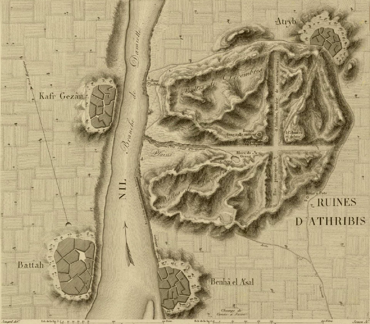
Deutsch: Karte von Athribis aus der Description de l'Egypte (1823). Die Pyramide ist in der Mitte des Ruinenhügels, an der linken oberen Ecke der Wegkreuzung eingezeichnet.
Español: Mapa de Atribis de Description de l'Egypte. La pirámide está en medio de las ruinas, junto a la esquina superior izquierda del cruce de caminos. Los caminos fueron trazados en tiempos de Roma.
Français : Relevé des ruines d'Athribis publié dans la Description de l'Égypte. Les ruines d'Athribis (la pyramide se situe près du centre) Description de l'Égypte.
Slovenčina: Pôdorys Athribu podľa Description de l’Égypte (1822). |
| Date | |
| Source | Description de l'Egypte, Volume 31, Planche 27 |
| Author |
Licensing
[edit]
|
This work is in the public domain in its country of origin and other countries and areas where the copyright term is the author's life plus 70 years or fewer. | |
| This file has been identified as being free of known restrictions under copyright law, including all related and neighboring rights. | |
File history
Click on a date/time to view the file as it appeared at that time.
| Date/Time | Thumbnail | Dimensions | User | Comment | |
|---|---|---|---|---|---|
| current | 18:46, 9 July 2007 | | 1,232 × 1,077 (829 KB) | Einsamer Schütze (talk | contribs) | == Summary == {{Information |Description= |Source=Description de l'Egypte, Volume 31, Planche 27 |Date=1823 |Author= |Permission= |other_versions= }} Category:Pyramids of Egypt == Licensing == {{PD-old}} |
You cannot overwrite this file.
File usage on Commons
The following page uses this file:
File usage on other wikis
The following other wikis use this file:
- Usage on ar.wikipedia.org
- Usage on arz.wikipedia.org
- Usage on ca.wikipedia.org
- Usage on de.wikipedia.org
- Usage on de.wikivoyage.org
- Usage on el.wikipedia.org
- Usage on en.wikipedia.org
- Usage on en.wikivoyage.org
- Usage on es.wikipedia.org
- Usage on fr.wikipedia.org
- Usage on ru.wikipedia.org
- Usage on sk.wikipedia.org
- Usage on sw.wikipedia.org
- Usage on uk.wikipedia.org
- Usage on www.wikidata.org