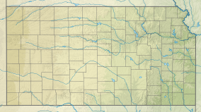
Webster State Park
Appearance
| Webster State Park | |
|---|---|
| Location | Rooks, Kansas, United States |
| Coordinates | 39°24′35″N 99°26′58″W / 39.40972°N 99.44944°W |
| Area | 880 acres (360 ha) |
| Elevation | 1,932 ft (589 m)[1] |
| Established | 1965 |
| Visitors | 143,400 (in 2022)[2] |
| Governing body | Kansas Department of Wildlife and Parks |
Webster State Park is a state park of Kansas, United States. It is located west of the city of Stockton in Rooks County. The park offers camping as well as boating on Webster Reservoir.
See also
[edit]References
[edit]- ^ "Webster State Park". Geographic Names Information System. United States Geological Survey. July 1, 1984. Retrieved December 5, 2012.
- ^ Self, Matthew (August 18, 2023). "Top 5 most popular Kansas state parks revealed". KSNT.
External links
[edit]

