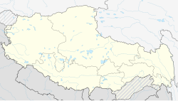
Huo'er
Appearance
This article needs to be updated. (January 2020) |
Huo'er
霍尔乡ཧོར་ཤང | |
|---|---|
Township | |
 | |
| Coordinates: 30°46′25″N 81°36′38″E / 30.7736°N 81.6105°E | |
| Country | People's Republic of China |
| Autonomous region | Tibet |
| Prefecture | Ngari |
| County | Burang County |
| Time zone | UTC+8 (China Standard) |
Hor (Tibetan: ཧོར, Wylie: hor) also known as Huo'er (Chinese: 霍尔乡; pinyin: huò'ěr xiāng) is a township in Burang County, Ngari Prefecture the Tibet Autonomous Region of China; by the shore of Lake Manasarovar.[1] It was placed in the back on the main East-West highway that followed the Silk Road from Lhasa to Kashmir.
References
- ^ Nick Middleton, 'Navel of the Universe', in Extremes along the Silk Road. Murray Books, 1905.

