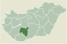
Pári
Appearance
Pári | |
|---|---|
 | |
| Coordinates: 46°34′47″N 18°15′28″E / 46.57972°N 18.25778°E | |
| Country | |
| County | Tolna |
| Area | |
| • Total | 13.06 km2 (5.04 sq mi) |
| Population (2010) | |
| • Total | 657 |
| • Density | 50.31/km2 (130.3/sq mi) |
| Time zone | UTC+1 (CET) |
| • Summer (DST) | UTC+2 (CEST) |
| Postal code | 7091 |
| Area code | 74 |
Pári is a village in Tolna county, Hungary. It is independent again from 2006 (previously it belonged to the municipality of Tamási).[citation needed]
The former railway section of line 49 between Pári and Tamási were converted into a bicycle trail in 2010.
External links
- Pári on Google Maps
- Website of the municipality of Pári (in Hungarian)


