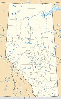
Cereal, Alberta
Cereal | |
|---|---|
| Hamlet of Cereal | |
 | |
Location in Alberta | |
| Coordinates: 51°24′56.1″N 110°47′59.5″W / 51.415583°N 110.799861°W | |
| Country | Canada |
| Province | Alberta |
| Region | Central Alberta |
| Census division | 4 |
| Special Area | No. 3 |
| Incorporated[1] | |
| • Village | August 19, 1914 |
| Dissolved[2] | January 1, 2021 |
| Government | |
| • Governing body | Special Areas Board |
| Area (2016)[3] | |
| • Land | 0.79 km2 (0.31 sq mi) |
| Elevation | 765 m (2,510 ft) |
| Population (2016)[3] | |
| • Total | 111 |
| • Density | 140.9/km2 (365/sq mi) |
| Time zone | UTC−7 (MST) |
| • Summer (DST) | UTC−6 (MDT) |
| Highways | Highway 9 Highway 886 |
Cereal is a hamlet within Special Area No. 3 in central Alberta, Canada.[4] It is approximately 161 km (100 mi) east of Drumheller. It was named after the post office that was established in the area in 1910.[5] The name of the post office alluded to grain fields near the community.[6] Cereal held village status prior to 2021.[2]
History
Cereal incorporated as a village on August 19, 1914.[1] It relinquished its village status on January 1, 2021, when it dissolved to become a hamlet under the jurisdiction of Special Area No. 3.[2]
Demographics
In the 2016 Census of Population conducted by Statistics Canada, Cereal recorded a population of 111 living in 59 of its 63 total private dwellings, a -17.2% change from its 2011 population of 134. With a land area of 0.79 km2 (0.31 sq mi), it had a population density of 140.5/km2 (363.9/sq mi) in 2016.[3]
In the 2011 Census, Cereal had a population of 134 living in 71 of its 79 total dwellings, a 6.3% change from its 2006 population of 126. With a land area of 0.95 km2 (0.37 sq mi), it had a population density of 141.1/km2 (365.3/sq mi) in 2011.[7]
Notable people
- Debby Carlson, Canadian politician, Liberal MLA (1993–2004)
- Marlene Streit, amateur golfer - won the Australian, British, Canadian and U.S. Women's Amateurs
See also
References
- ^ a b "Location and History Profile: Village of Cereal" (PDF). Alberta Municipal Affairs. October 14, 2016. p. 141. Retrieved October 17, 2016.
- ^ a b c "O.C.". Government of Alberta. December 9, 2020. Retrieved January 3, 2021.
- ^ a b c "Population and dwelling counts, for Canada, provinces and territories, and census subdivisions (municipalities), 2016 and 2011 censuses – 100% data (Alberta)". Statistics Canada. February 8, 2017. Retrieved February 8, 2017.
- ^ "Specialized and Rural Municipalities and Their Communities" (PDF). Alberta Municipal Affairs. June 3, 2024. Retrieved June 14, 2024.
- ^ Cereal Women's Institute (1967). Down Cereal's Memory Trails, 1910-1967. Cereal, Alberta. p. 3. Archived from the original on September 24, 2015. Retrieved July 8, 2013.
{{cite book}}: CS1 maint: location missing publisher (link) - ^ Place-names of Alberta. Ottawa: Geographic Board of Canada. 1928. p. 32.
- ^ "Population and dwelling counts, for Canada, provinces and territories, and census subdivisions (municipalities), 2011 and 2006 censuses (Alberta)". Statistics Canada. February 8, 2012. Retrieved February 8, 2012.

