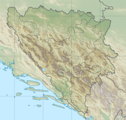
Oličko Lake
Appearance
| Oličko Lake | |
|---|---|
| Coordinates | 44°14′20″N 17°04′25″E / 44.23889°N 17.07361°E |
| Basin countries | Bosnia and Herzegovina |
| Max. length | 0.25 km (0.16 mi) |
| Max. width | 0.2 km (0.12 mi) |
| Surface area | .04 km2 (0.015 sq mi) |
| Max. depth | 30 m (98 ft) |
 | |
Olićko Lake is a lake of Bosnia and Herzegovina, the lake is near of village Olići, in the municipality of Šipovo.[1]
See also
References
- ^ Zavod za zaštitu spomenika kulture S.R. Bosne i Hercegovine; Zavod za zaštitu spomenika kulture prirodnih znamenitosti i rijetkosti Bosne i Hercegovine (1960). Zavod za zaštitu spomenika kulture S.R. Bosne i Hercegovine (ed.). "Naše starine, Volumes 7-8". p. 251.

