Pen y Brynfforchog
Appearance
| Pen y Brynfforchog | |
|---|---|
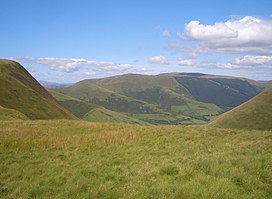
 Pen y Brynfforchog with Glasgwm (right) from Cribin Fawr | |
| Highest point | |
| Elevation | 685 m (2,247 ft) |
| Prominence | 71 m (233 ft) |
| Parent peak | Glasgwm |
| Listing | Hewitt, Nuttall |
| Coordinates | 52°44′46″N 3°45′10″W / 52.7462°N 3.7529°W |
| Geography | |
| Location | Gwynedd, Wales |
| Parent range | Snowdonia |
| OS grid | SH817179 |
| Topo map | OS Landranger 124 |
Pen y Brynfforchog is subsidiary summit of Glasgwm in North Wales forming part of the Aran range in southern Snowdonia.[1]
It is separated from Glasgwm by the pass, Bwlch y Fign. The summit is bare and marked by a few stones. The views to the Dyfi hills: include direct view of the Craig Portas ridge, with Maesglase and Cribin Fawr.[2]
References
- ^ Nuttall, John & Anne (1999). The Mountains of England & Wales - Volume 1: Wales (2nd edition ed.). Milnthorpe, Cumbria: Cicerone. ISBN 1-85284-304-7.
- ^ Crocker, Chris; Graham Jackson. "Mountaineering & Rock Climbing in the UK: Glasgwm". Database of British Hills. Mountain Days.net. Archived from the original on 19 July 2011. Retrieved 8 April 2008.
