Doesburg
Appearance
Doesburg
Doezebarg | |
|---|---|
Municipality, city | |
 | |
 Location | |
 Map | |
| Coordinates: 52°1′N 6°8′E / 52.017°N 6.133°E | |
| Country | Netherlands |
| Province | Gelderland |
| Region | Achterhoek, IJsselvallei, Liemers |
| Area | |
| • Total | 12.96 km2 (5.00 sq mi) |
| • Land | 11.53 km2 (4.45 sq mi) |
| • Water | 1.43 km2 (0.55 sq mi) |
| Elevation | 13 m (43 ft) |
| Population (2019) | |
| • Total | 11,148 |
| • Density | 967/km2 (2,500/sq mi) |
| Website | www |
Doesburg is a municipality and city in the province of Gelderland, the Netherlands. About 11,000 people were living there in 2021.
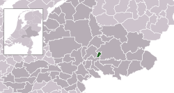
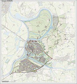
Doesburg lies on the east bank of the IJssel river in the region of IJsselvallei. The northern part belongs also to the region of Achterhoek, the southern part also to the region of Liemers. The Oude IJssel river flows into the IJssel river in Doesburg.
It got city rights in 1237 and became a member of the Hanseatic League in 1447.
Doesburg is well-known for its mustard.


