
Fayl:Austria location map.svg

Size of this PNG preview of this SVG file: 800 × 446 pixels. Other resolutions: 320 × 178 pixels | 640 × 357 pixels | 1 024 × 571 pixels | 1 280 × 713 pixels | 2 560 × 1 427 pixels | 1 256 × 700 pixels.
Original file (SVG file, nominally 1 256 × 700 pixels, file size: 161 KB)
Summary
| Description |
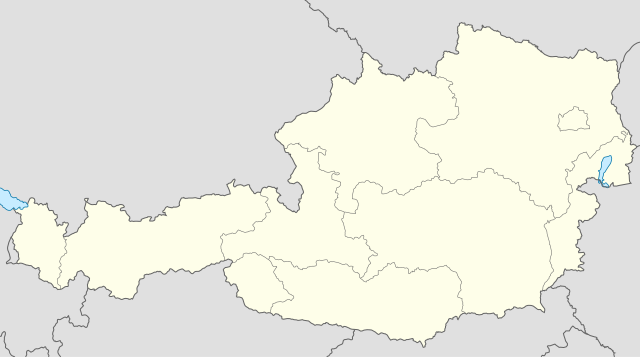
Deutsch: Positionskarte von Österreich
Quadratische Plattkarte, N-S-Streckung 150 %. Geographische Begrenzung der Karte:
English: Location map of Austria
Equirectangular projection, N/S stretching 150 %. Geographic limits of the map:
Italiano: Mappa dell'Austria
Proiezione cilindrica equidistante, N-S che si estende al 150%. Limiti geografici della mappa:
|
||
| Date | |||
| Source | Own work (Original text: own work, using United States National Imagery and Mapping Agency data) | ||
| Author | Lencer | ||
| Other versions |
|
||
| SVG genesis | This locator map was created with Inkscape.
|


Licensing
I, the copyright holder of this work, hereby publish it under the following licenses:

|
Permission is granted to copy, distribute and/or modify this document under the terms of the GNU Free Documentation License, Version 1.2 or any later version published by the Free Software Foundation; with no Invariant Sections, no Front-Cover Texts, and no Back-Cover Texts. A copy of the license is included in the section entitled GNU Free Documentation License. |
This file is licensed under the Creative Commons Attribution-Share Alike 3.0 Unported license.
- You are free:
- to share – to copy, distribute and transmit the work
- to remix – to adapt the work
- Under the following conditions:
- attribution – You must give appropriate credit, provide a link to the license, and indicate if changes were made. You may do so in any reasonable manner, but not in any way that suggests the licensor endorses you or your use.
- share alike – If you remix, transform, or build upon the material, you must distribute your contributions under the same or compatible license as the original.
You may select the license of your choice.
–
File history
Click on a date/time to view the file as it appeared at that time.
| Date/Time | Thumbnail | Dimensions | User | Comment | |
|---|---|---|---|---|---|
| current | 16:25, 11 September 2008 | | 1 256 × 700 (161 KB) | Lencer | {{Information |Description= |Source= |Date= |Author= |Permission= |other_versions= }} |
| 15:16, 10 September 2008 |  | 1 256 × 700 (157 KB) | Lencer | {{Information |Description= |Source= |Date= |Author= |Permission= |other_versions= }} | |
| 11:34, 18 July 2008 |  | 1 256 × 700 (149 KB) | NordNordWest | {{Information |Description= {{de|Positionskarte von Österreich}} Quadratische Plattkarte, N-S-Streckung 150 %. Geographische Begrenzung der Karte: * N: 49.2° N * S: 46.3° N * W: 9.4° O * O: 17.2° O {{en|Location map of [[: |
File usage
More than 100 pages use this file. The following list shows the first 100 pages that use this file only. A full list is available.
- Andau
- Antau
- Apetlon
- Bad Sauerbrunn
- Bad Tatzmannsdorf
- Badersdorf
- Baumgarten (Burgenland)
- Bernstein im Burgenland
- Bildein
- Bocksdorf
- Breitenbrunn am Neusiedler See
- Bruckneudorf
- Burgauberg-Neudauberg
- Deutsch Jahrndorf
- Deutsch Kaltenbrunn
- Deutsch Schützen-Eisenberg
- Deutschkreutz
- Donnerskirchen
- Draßburg
- Draßmarkt
- Edelstal
- Frauenkirchen
- Gattendorf (Burgenland)
- Gerersdorf-Sulz
- Gols
- Grafenschachen
- Großhöflein (Burgenland)
- Großmürbisch
- Großpetersdorf
- Großwarasdorf
- Güssing
- Güttenbach
- Halbturn
- Hornstein (Burgenland)
- Illmitz
- Inzenhof
- Jennersdorf
- Jois
- Kaisersdorf
- Kemeten
- Kittsee
- Kleinmürbisch
- Klingenbach
- Kobersdorf
- Kohfidisch
- Krensdorf
- Kukmirn
- Königsdorf (Burgenland)
- Lackenbach
- Lackendorf
- Leithaprodersdorf
- Litzelsdorf
- Lockenhaus
- Loipersbach im Burgenland
- Loipersdorf-Kitzladen
- Loretto (Burgenland)
- Lutzmannsburg
- Mannersdorf an der Rabnitz
- Mariasdorf
- Markt Allhau
- Mönchhof
- Mörbisch am See
- Müllendorf
- Neudorf bei Parndorf
- Neufeld an der Leitha
- Neusiedl am See
- Nickelsdorf
- Oslip
- Pama
- Pamhagen
- Parndorf
- Podersdorf am See
- Potzneusiedl
- Purbach am Neusiedler See
- Sankt Andrä am Zicksee
- Sankt Georgen am Leithagebirge
- Sankt Margarethen im Burgenland
- Schützen am Gebirge
- Siegendorf
- Sieggraben
- Sigleß
- Steinbrunn
- Stotzing
- Tadten
- Trausdorf an der Wulka
- Wallern im Burgenland
- Weichselbaum (Burgenland)
- Weiden am See
- Weiden bei Rechnitz
- Weingraben
- Weppersdorf
- Wiesen (Burgenland)
- Wiesfleck
- Willersdorf (Gemeinde Oberschützen)
- Wimpassing an der Leitha
- Winden am See
- Wolfau
- Wulkaprodersdorf
- Wörterberg
- Zagersdorf
View more links to this file.
Global file usage
The following other wikis use this file:
- Usage on af.wikipedia.org
- Usage on als.wikipedia.org
- Egg (Vorarlberg)
- Salzburg
- Hohenems
- Bregenz
- Wien
- Lustenau
- Feldkirch (Vorarlberg)
- Satteins
- Dornbirn
- Altach
- Vorlage:Infobox Ort in Österreich
- Vorlage:Positionskarte Österreich
- Mäder
- Klaus (Vorarlberg)
- Koblach
- Götzis
- Weiler (Vorarlberg)
- Bludenz
- Zwischenwasser
- Frastanz
- Innsbruck
- Höchst (Vorarlberg)
- Alberschwende
- Andelsbuch
- Au (Vorarlberg)
- Bartholomäberg
- Bezau
- Bildstein (Vorarlberg)
- Bizau
- Blons
- Bludesch
- Brand (Vorarlberg)
- Buch (Vorarlberg)
- Bürs
- Bürserberg
- Dalaas
- Damüls
- Doren
- Düns
- Dünserberg
- Eichenberg (Vorarlberg)
- Fontanella
- Fraxern
- Fußach
- Gaißau
- Gaschurn
- Göfis
- Hard
View more global usage of this file.