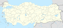
Tersane Island
Native name: Tersane Adası | |
|---|---|
| Geography | |
| Location | Mediterranean Sea |
| Coordinates | 36°40′14″N 28°55′09″E / 36.67056°N 28.91917°E |
| Administration | |
| İl (province) | Muğla Province |
| İlçe | Fethiye |
Tersane Island (Turkish: Tersane Adası, literally Shipyard island) is a Mediterranean island of Turkey.
Location
Administratively, the island is a part of Fethiye ilçe (district) of Muğla Province. It is situated in the Gulf of Fethiye at 36°40′14″N 28°55′09″E / 36.67056°N 28.91917°E.[1] It is separated from Domuz Island by a narrow channel to the west. The triangular island has a surface area of about 2.5 square kilometres (0.97 sq mi) . There are three small bays and the bay at the north west corner is well protected. The northeast part of the bay has a very shallow harbour.[2]
History
The ancient name of the island was Telandria (Ancient Greek: Τηλανδρία)[3][4] and Telandros (Ancient Greek: Τήλανδρος).[5] There are ruins from the Lycian era.[2] During the Ottoman Empire age the island was probably a ship building and repair harbor.[3] the population of the island left the island following the Population exchange agreement between Greece and Turkey.[3] Although the island is currently uninhabited there is a restaurant with a quay for the yachters.[6]
References
- ^ Map page
- ^ a b Yachting page (in Turkish)
- ^ a b c Neredekal page (in Turkish)
- ^ Lund University. Digital Atlas of the Roman Empire.
- ^ Stephanus of Byzantium, Ethnica, § T620.1
- ^ Coast guide

