Category:Gujarati-language SVG maps
Jump to navigation
Jump to search
Subcategories
This category has only the following subcategory.
Media in category "Gujarati-language SVG maps"
The following 31 files are in this category, out of 31 total.
-
 African quadripoint-gu.svg 512 × 512; 44 KB
-
 Anaximander world map-gu.svg 1,063 × 1,063; 15 KB
-
 Assam-districts-2001-gu.svg 631 × 530; 212 KB
-
 Bhavnagar district Ghogha Taluka map.svg 1,321 × 871; 1.1 MB
-
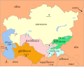
 Central Asia - political map - 2000-gu.svg 995 × 790; 161 KB
-
 Central Asia - political map 2008-gu.svg 996 × 790; 165 KB
-
 Dadra & Nagar Haveli gu.svg 380 × 366; 74 KB
-
 Delhi Municipalities-gu.svg 600 × 600; 12 KB
-
 Haryana 2011 administrative-gu.svg 829 × 672; 575 KB
-
 India Union Territories-gu.svg 1,500 × 1,615; 1.73 MB
-
 India-map-gu.svg 1,519 × 1,773; 259 KB
-
 Lincoln Sea map-gu.svg 1,000 × 913; 201 KB
-
 MANIPUR district map-gu.svg 640 × 715; 167 KB
-
 Map Gulf of Finland-gu.svg 1,400 × 800; 28 KB
-
 Meghalaya 2012-gu.svg 807 × 434; 157 KB
-
 Naval bases of India-gu.svg 1,486 × 1,734; 325 KB
-
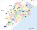 Orissa State map-gu.svg 2,184 × 1,769; 1.76 MB
-
 Orissa State map Gu.svg 2,184 × 1,769; 1 MB
-
 Puducherry District - Local bodies-gu.svg 979 × 1,057; 45 KB
-
 Punjab 2012 administrative-gu.svg 900 × 600; 163 KB
-
 Rwanda - Location Map (2011) - RWA - GU.svg 250 × 250; 344 KB
-
 SevenSisterStates-gu.svg 606 × 615; 1 MB
-
 Simple vector map-gu.svg 250 × 200; 6 KB
-
 Tamil Nadu district map-gu.svg 1,640 × 2,032; 144 KB
-
 Tripura-district-map-gu.svg 545 × 688; 248 KB
-
 Up-subregions2-gu.svg 2,400 × 2,515; 243 KB
-
 Uttar Pradesh administrative divisions-gu.svg 1,500 × 1,500; 122 KB
-
 UttarakhandDistricts numbered-gu.svg 1,250 × 1,125; 147 KB
-
 Wahlkreise zur Vidhan Sabha von Gujarat gu.svg 1,420 × 1,080; 6.66 MB
-
 WestBengalDistricts numbered-gu.svg 576 × 601; 144 KB
-
 Zonal Councils-gu.svg 1,594 × 1,868; 226 KB


_-_RWA_-_GU.svg)


