Category:SVG maps of Portugal
Jump to navigation
Jump to search
Subcategories
This category has the following 11 subcategories, out of 11 total.
*
B
D
F
- SVG flag maps of Portugal (10 F)
H
- Maps of highways in Portugal (42 F)
L
M
T
- SVG topographic maps of Portugal (22 F)
Media in category "SVG maps of Portugal"
The following 193 files are in this category, out of 193 total.
-
 Abortion Map Portugal 1998 de.svg 744 × 1,052; 210 KB
-
 Abortion Map Portugal 2007 de.svg 744 × 1,052; 210 KB
-
 Alentejo region location map.svg 560 × 793; 5 MB
-
 Algarve region location map.svg 560 × 793; 5 MB
-
 AM Lisboa.svg 267 × 390; 260 KB
-
 AM Porto.svg 267 × 390; 260 KB
-
 AMP location map.png 2,000 × 2,832; 381 KB
-
 Beiras e Serra da Estrela.svg 558 × 709; 70 KB
-
 Berlengas archipelago geology-en.svg 1,183 × 1,593; 77 KB
-
 Berlengas archipelago geology-fr.svg 1,183 × 1,593; 77 KB
-
 Berlengas archipelago geology-mk.svg 1,183 × 1,593; 77 KB
-
 Blank map of the Portuguese regions.svg 721 × 1,122; 149 KB
-
 Carta Archeologica do Algarve 1878.svg 6,816 × 4,946; 7.14 MB
-
 Central Portugal location map.svg 560 × 793; 5 MB
-
 China Portugal Locator.svg 940 × 415; 1.76 MB
-
 CIM Alentejo Central.svg 267 × 390; 260 KB
-
 CIM Alentejo Litoral.svg 267 × 390; 260 KB
-
 CIM Algarve.svg 267 × 390; 260 KB
-
 CIM Alto Alentejo.svg 267 × 390; 260 KB
-
 CIM Alto Minho.svg 267 × 390; 260 KB
-
 CIM Alto Tâmega.svg 267 × 390; 260 KB
-
 CIM Ave.svg 267 × 390; 260 KB
-
 CIM Baixo Alentejo.svg 267 × 390; 260 KB
-
 CIM Beira Baixa (2024).svg 267 × 390; 260 KB
-
 CIM Beira Baixa.svg 250 × 366; 192 KB
-
 CIM Beiras e Serra da Estrela.svg 267 × 390; 260 KB
-
 CIM Cávado.svg 267 × 390; 260 KB
-
 CIM Douro.svg 267 × 390; 260 KB
-
 CIM Lezíria do Tejo.svg 267 × 390; 260 KB
-
 CIM Médio Tejo (2024).svg 267 × 390; 260 KB
-
 CIM Médio Tejo.svg 250 × 366; 192 KB
-
 CIM Oeste.svg 267 × 390; 260 KB
-
 CIM Região de Aveiro.svg 267 × 390; 260 KB
-
 CIM Região de Coimbra.svg 267 × 390; 260 KB
-
 CIM Região de Leiria.svg 267 × 390; 260 KB
-
 CIM Terras de Trás-os-Montes.svg 267 × 390; 260 KB
-
 CIM Tâmega e Sousa.svg 267 × 390; 260 KB
-
 CIM Viseu Dão Lafões.svg 267 × 390; 260 KB
-
 Clima de Portugal (Köppen).svg 765 × 1,701; 270 KB
-
 Concelhos-sede de ONGAs.svg 250 × 366; 891 KB
-
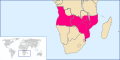
 Countries with Historical Portuguese Territories.svg 940 × 477; 1.56 MB
-
 CSC loc.svg 512 × 315; 1.29 MB
-
 Diagrama Linha Amarela.svg 842 × 595; 583 KB
-
 Distribuição do Bis-bis.svg 1,000 × 858; 64 KB
-
 Drainage basin of the Rio Guadiana (V2).svg 947 × 570; 104 KB
-
 Drainage basin of the Rio Guadiana fr (V2).svg 1,463 × 795; 232 KB
-
 Drainage basin of the Rio Guadiana-fr.svg 1,490 × 894; 201 KB
-
 Drainage basin of the Rio Guadiana.svg 947 × 570; 93 KB
-
 EEC-10 Portugal Locator (with internal borders).svg 680 × 520; 491 KB
-
 EEC-10 Portugal Locator.svg 680 × 520; 440 KB
-
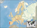 EU location POR.svg 1,600 × 1,200; 2.47 MB
-
 EU-Portugal with Madeira circled.svg 2,080 × 1,717; 2.05 MB
-
 Europe location POR-ALG.svg 1,600 × 1,200; 1.11 MB
-
 Famílias Linha de Cascais até 2011.svg 595 × 850; 273 KB
-
 Famílias Linha de Cascais.svg 595 × 850; 259 KB
-
 Georgia Portugal Locator.svg 680 × 520; 597 KB
-
 IBERIA (freehand map).svg 512 × 289; 152 KB
-
 Ilhéu da Cal location map.svg 1,590 × 1,365; 21 KB
-
 Ilhéu da Fonte da Areia location map.svg 1,590 × 1,365; 21 KB
-
 Ilhéu das Cenouras location map.svg 1,590 × 1,365; 21 KB
-
 Ilhéu de Cima location map.svg 1,590 × 1,365; 21 KB
-
 Ilhéu de Ferro location map.svg 1,590 × 1,365; 21 KB
-
 Ilhéu de Fora location map.svg 1,590 × 1,365; 22 KB
-
 Indonesia Portugal Locator.svg 940 × 415; 1.83 MB
-
 Kartódromo de Fafe.svg 512 × 725; 56 KB
-
 Kingdom of Portugal (1890).svg 450 × 456; 422 KB
-
 Linha Azul ML 2011.svg 360 × 250; 406 KB
-
 Linha Verde ML 2011.svg 360 × 250; 339 KB
-
 Linha Vermelha ML 2011.svg 984 × 532; 184 KB
-
 Lisbon Lighthouses.svg 934 × 591; 5 KB
-
 Lisbon metro.svg 1,031 × 976; 86 KB
-
 Lisbon metropolitan area location map.svg 560 × 793; 5 MB
-
 LocalMargemSul.svg 250 × 366; 252 KB
-
 LocalNUTS3AlentejoCentral.svg 250 × 366; 240 KB
-
 LocalNUTS3AlentejoLitoral.svg 250 × 366; 240 KB
-
 LocalNUTS3Algarve.svg 250 × 366; 240 KB
-
 LocalNUTS3AltoAlentejo.svg 250 × 366; 240 KB
-
 LocalNUTS3AltoTrasOsMontes.svg 250 × 366; 240 KB
-
 LocalNUTS3Ave.svg 250 × 366; 240 KB
-
 LocalNUTS3BaixoAlentejo.svg 250 × 366; 240 KB
-
 LocalNUTS3BaixoMondego.svg 250 × 366; 240 KB
-
 LocalNUTS3BaixoVouga.svg 250 × 366; 240 KB
-
 LocalNUTS3BeiraInteriorNorte.svg 250 × 366; 240 KB
-
 LocalNUTS3BeiraInteriorSul.svg 250 × 366; 240 KB
-
 LocalNUTS3Cavado.svg 250 × 366; 240 KB
-
 LocalNUTS3CovaDaBeira.svg 250 × 366; 240 KB
-
 LocalNUTS3DaoLafoes.svg 250 × 366; 240 KB
-
 LocalNUTS3Douro.svg 250 × 366; 240 KB
-
 LocalNUTS3EntreDouroEVouga.svg 250 × 366; 240 KB
-
 LocalNUTS3GrandeLisboa.svg 250 × 366; 240 KB
-
 LocalNUTS3GrandePorto.svg 250 × 366; 240 KB
-
 LocalNUTS3LeziriaDoTejo.svg 250 × 366; 240 KB
-
 LocalNUTS3MedioTejo.svg 250 × 366; 240 KB
-
 LocalNUTS3MinhoLima.svg 250 × 366; 240 KB
-
 LocalNUTS3Oeste.svg 250 × 366; 240 KB
-
 LocalNUTS3PeninsulaDeSetubal.svg 250 × 366; 240 KB
-
 LocalNUTS3PinhalInteriorNorte.svg 250 × 366; 240 KB
-
 LocalNUTS3PinhalInteriorSul.svg 250 × 366; 240 KB
-
 LocalNUTS3PinhalLitoral.svg 250 × 366; 240 KB
-
 LocalNUTS3SerraDaEstrela.svg 250 × 366; 240 KB
-
 LocalNUTS3Tamega.svg 250 × 366; 240 KB
-
 LocalRegiaoAlentejo.svg 512 × 750; 355 KB
-
 LocalRegiaoAlgarve.svg 512 × 750; 355 KB
-
 LocalRegiaoCentro.svg 512 × 750; 355 KB
-
 LocalRegiaoLisboa.svg 595 × 842; 517 KB
-
 LocalRegiaoNorte.svg 512 × 750; 355 KB
-
 LocAMP.svg 560 × 793; 4.99 MB
-
 Location Madeira Africa.svg 1,400 × 1,300; 2.16 MB
-
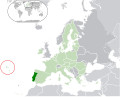
 LocationPortugal.svg 1,000 × 500; 2.76 MB
-
 Locator map AZO FLO.svg 886 × 709; 1.07 MB
-
 Locator map of Azores in EU.svg 2,142 × 1,719; 2.02 MB
-
 Locator map of Madeira in EU.svg 2,142 × 1,719; 2.02 MB
-
 Locator map of Portugal.svg 680 × 520; 658 KB
-
 LocOeste.svg 560 × 793; 5.06 MB
-
 Map of Guimarães city.svg 2,774 × 2,219; 1.61 MB
-
 Map of Região Autónoma da Madeira.svg 6,524 × 9,109; 193 KB
-
 Mapa Cor-de-Rosa.svg 1,000 × 500; 2.76 MB
-
 Mapa das regiões portuguesas por PIB.svg 721 × 1,122; 155 KB
-
 Mapa de Espanha (OCHA).svg 254 × 254; 1,003 KB
-
 Mapa de Portugal OCHA.svg 254 × 255; 1,001 KB
-
 Mapa Margem Sul.svg 512 × 315; 37 KB
-
 Mapa serviço Intercidades.svg 595 × 850; 368 KB
-
 Mapa Urbanos Coimbra até 2009.svg 595 × 850; 304 KB
-
 Mapa Urbanos Coimbra.svg 595 × 850; 157 KB
-
 Metro do Porto.svg 512 × 251; 354 KB
-
 MLD-ViasDeComunicação.svg 555 × 535; 115 KB
-
 MLD-ViasRomanas.svg 2,607 × 2,569; 35 KB
-
 MunicipalityGroupings NUTS2&3 Portugal 2024.svg 267 × 390; 821 KB
-
 MunicipalityGroupingsInPortugal.svg 250 × 366; 739 KB
-
 Muralha Primitiva (Porto).svg 744 × 1,052; 30 KB
-
 Muralhas Fernandinas.svg 2,718 × 2,512; 123 KB
-
 Northern Portugal location map.svg 560 × 793; 5 MB
-
 NUTS3 Portugal (2024) legendado.svg 267 × 390; 273 KB
-
 NUTS3 Portugal (2024).svg 267 × 390; 260 KB
-
 Pacific Area - The Imperial Powers 1939 - Map mk.svg 1,039 × 814; 4.43 MB
-
 Pacific Area - The Imperial Powers 1939 - Map-es.svg 1,039 × 814; 2.89 MB
-
 PIIGGSmap.svg 454 × 450; 478 KB
-
 Port of Funchal map.svg 1,590 × 1,365; 68 KB
-
 Porto Foz de Douro Map.svg 3,293 × 1,836; 14.04 MB
-
 Portugal (orthographic projection).svg 553 × 553; 372 KB
-
 Portugal - areas protegidas.svg 312 × 600; 274 KB
-
 Portugal - areas protegidas2.svg 312 × 600; 192 KB
-
 Portugal - Location Map (2013) - PRT - UNOCHA.svg 251 × 251; 953 KB
-
 Portugal administrative map-fr.svg 1,738 × 3,070; 5.67 MB
-
 Portugal Azores location map.svg 1,304 × 786; 21 KB
-
 Portugal Exclusive Economic Zone (en).svg 365 × 265; 9 KB
-
 Portugal Exclusive Economic Zone (fr).svg 362 × 262; 14 KB
-
 Portugal Exclusive Economic Zone (pt).svg 365 × 265; 9 KB
-
 Portugal Georgia Locator.svg 680 × 520; 597 KB
-
 Portugal Köppen.svg 765 × 1,701; 955 KB
-
 Portugal NUTS III (2013).svg 250 × 366; 214 KB
-
 Portugal par régions sans noms.svg 600 × 650; 60 KB
-
 Portugal regions map.svg 250 × 366; 2.63 MB
-
 Portugal USA Locator.svg 940 × 415; 1.76 MB
-
 Portugaliza map-fr.svg 1,739 × 3,785; 1.55 MB
-
 Portugaliza map-pt.svg 1,739 × 3,785; 1.35 MB
-
 Portuguese colonial war blank map.svg 635 × 709; 514 KB
-
 Portuguese colonial war-ar.svg 677 × 756; 480 KB
-
 Portuguese colonial war-en.svg 635 × 709; 516 KB
-
 Portuguese colonial war-es.svg 635 × 709; 517 KB
-
 Portuguese colonial war-fr.svg 635 × 709; 517 KB
-
 Portuguese colonial war-pl.svg 635 × 709; 516 KB
-
 Portuguese exports-fr.svg 940 × 415; 1.51 MB
-
 Rede ferroviária portuguesa (2023).svg 1,400 × 2,400; 78 KB
-
 Regiao Centro in Portugal (with subregions).svg 188 × 157; 135 KB
-
 Regiao de Lisboa in Portugal (with subregions).svg 345 × 241; 145 KB
-
 Regiao do Alentejo in Portugal (with subregions).svg 188 × 167; 132 KB
-
 Regiao do Algarve in Portugal (with subregions).svg 516 × 225; 145 KB
-
 Regiao Norte in Portugal (with subregions).svg 188 × 105; 132 KB
-
 Regions of Portugal by HDI (2017).svg 512 × 885; 207 KB
-
 Regions of Portugal by HDI (2019).svg 512 × 885; 501 KB
-
 Região Autónoma da Madeira islands (location).svg 4,787 × 3,424; 142 KB
-
 Região Autónoma da Madeira islands.svg 4,787 × 3,424; 195 KB
-
 Região Autónoma da Madeira location map.svg 6,524 × 9,109; 142 KB
-
 Regiões de Portugal por PIB (2021).svg 512 × 885; 216 KB
-
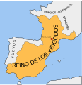 Reino de los visigodos.svg 653 × 678; 59 KB
-
 Rio mondego.svg 110 × 200; 11 KB
-
 Rio sado.svg 110 × 200; 10 KB
-
 Rio zezere.svg 110 × 200; 13 KB
-
 Strecke Metro Porto.svg 1,666 × 2,085; 509 KB
-
 SUGL.svg 1,134 × 850; 414 KB
-
 São Bartolomeu dos Galegos paroisse map.svg 1,583 × 1,331; 571 KB
-
 Taxe sur l'arborisation des municipalités portugaises.svg 250 × 366; 622 KB
-
 Territorial waters - Portugal.svg 800 × 400; 694 KB
-
 TFGL.svg 992 × 1,276; 820 KB
-
 Tram tracks map Lisbon 1959.svg 1,258 × 908; 2.35 MB
-
 TramCCFLmapa(pt).svg 1,258 × 908; 1.66 MB
-
 Tree types of Portugal.svg 200 × 389; 144 KB
-
 Vias romanas (Porto).svg 431 × 536; 34 KB
-
 Vignoble du vinho verde.svg 683 × 833; 295 KB
-
 Vinho verde locator map.svg 250 × 367; 280 KB
-
 Vinho verde map.svg 394 × 485; 313 KB
-
 Vuelo Gago Coutinho y Sacadura Cabral.svg 556 × 625; 34 KB


.svg)


.svg)


.svg)


.svg)
.svg)


.svg)


.svg)


.svg)


.svg)


.svg)


_legendado.svg)
.svg)


.svg)


_-_PRT_-_UNOCHA.svg)


.svg)
.svg)
.svg)


.svg)


.svg)
.svg)
.svg)
.svg)
.svg)
.svg)
.svg)
.svg)
.svg)


.svg)


.svg)

.svg)


