
Karaj County
Karaj County
Persian: شهرستان کرج | |
|---|---|
 Karaj in winter | |
 Location of Karaj County in Alborz province (right, green) | |
 Location of Alborz province in Iran | |
| Coordinates: 35°58′N 51°05′E / 35.967°N 51.083°E[1] | |
| Country | |
| Province | Alborz |
| Capital | Karaj |
| Districts | Central, Asara |
| Population (2016)[2] | |
| • Total | 1,973,470 |
| Time zone | UTC+3:30 (IRST) |
| Karaj County can be found at GEOnet Names Server, at this link, by opening the Advanced Search box, entering "9206117" in the "Unique Feature Id" form, and clicking on "Search Database". | |
Karaj County (Persian: شهرستان کرج) is in Alborz province, Iran.[3] Its capital is the city of Karaj.[4]
History
[edit]In 2009, three villages merged in the creation of the city of Asara.[5] In 2010, the county separated from Tehran province in the establishment of Alborz province.[3]
In 2012, Eshtehard District was separated from the county in the establishment of Eshtehard County.[6] In 2013, the city of Meshkin Dasht and other parts were separated from the county in the establishment of Fardis County.[7]
Demographics
[edit]Population
[edit]At the time of the 2006 National Census, the county's population was 1,709,481 in 472,365 households.[8] The 2016 census measured the population of the county as 1,973,470 in 623,801 households.[2]
Administrative divisions
[edit]Karaj County's population history and administrative structure over two censuses are shown in the following table.
| Administrative Divisions | 2006[8] | 2016[2] | |
|---|---|---|---|
| Central District | 1,667,024 | 1,956,267 | |
| Garmdarreh RD | 544 | 221 | |
| Kamalabad RD | 3,836 | 4,892 | |
| Mohammadabad RD | 22,099 | 11,939 | |
| Garmdarreh (city) | 12,738 | 22,726 | |
| Kamal Shahr (city) | 80,435 | 141,669 | |
| Karaj (city) | 1,377,450 | 1,592,492 | |
| Mahdasht (city) | 43,100 | 62,910 | |
| Meshkin Dasht (city)[b] | 43,696 | ||
| Mohammadshahr (city) | 83,126 | 119,418 | |
| Asara District | 18,856 | 17,150 | |
| Adaran RD | 8,995 | 7,679 | |
| Asara RD | 3,780 | 3,063 | |
| Nesa RD | 6,081 | 5,069 | |
| Asara (city) | 1,339 | ||
| Eshtehard District[c] | 23,601 | ||
| Palangabad RD | 6,613 | ||
| Eshtehard (city) | 16,988 | ||
| Total | 1,709,481 | 1,973,470 | |
| RD = Rural District | |||
Gallery
[edit]-
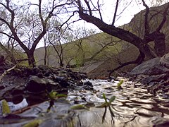 Karaj Valley
 -


See also
[edit]![]() Media related to Karaj County at Wikimedia Commons
Media related to Karaj County at Wikimedia Commons
Notes
[edit]- ^ As a part of Tehran province at the 2006 census
- ^ Transferred to Fardis County[7]
- ^ Transferred to Eshtehard County[6]
References
[edit]- ^ OpenStreetMap contributors (17 August 2024). "Karaj County" (Map). openstreetmap.org (OpenStreetMap) (in Persian). Retrieved 17 August 2024.
- ^ a b c Census of the Islamic Republic of Iran, 1395 (2016): Alborz Province. amar.org.ir (Report) (in Persian). The Statistical Center of Iran. Archived from the original (Excel) on 28 January 2020. Retrieved 19 December 2022.
- ^ a b Larijani, Ali (2010) [Approved 16 April 1389]. Alborz province establishment law. lamtakam.com (Report) (in Persian). Guardian Council. Notification 412/30588. Archived from the original on 16 December 2023. Retrieved 21 August 2024 – via Lam ta Kam.
- ^ Habibi, Hassan (10 December 2014) [Approved 21 June 1369]. Approval of the organization and chain of citizenship of the elements and units of the national divisions of Tehran province centered on the city of Tehran. rc.majlis.ir (Report) (in Persian). Ministry of Interior, Defense Political Commission of the Government Board. Notification 8416/T133K. Archived from the original on 30 November 2014. Retrieved 16 December 2023 – via Islamic Parliament Research Center.
- ^ Davodi, Parviz (2009) [Approved 1 October 1386]. Approval letter regarding the conversion of Asara village, the center of Asara District, from the functions of Karaj County in Tehran province, to the city. Lamtakam (Report) (in Persian). Ministry of Interior, Political and Defense Commission. Notification 216754/T40621K. Archived from the original on 15 December 2023. Retrieved 21 August 2024 – via Lam ta Kam.
- ^ a b Rahimi, Mohammad Reza (2012) [Approved 17 March 1391]. Approval letter regarding national divisions in Alborz province. rc.majlis.ir (Report) (in Persian). Ministry of the Interior, Board of Ministers. Notification 50868/T46965H. Archived from the original on 5 February 2013. Retrieved 21 August 2024 – via The Research Center of the Islamic Council of Iran.
- ^ a b Rahimi, Mohammad Reza (1 July 2013) [Approved 29 March 1392]. Approval letter regarding country divisions in Alborz province. rc.majlis.ir (Report) (in Persian). Ministry of the Interior, Council of Ministers. Notification 84917/T49173H. Archived from the original on 26 July 2013. Retrieved 21 August 2024 – via The Research Center of the Islamic Council of Iran.
- ^ a b Census of the Islamic Republic of Iran, 1385 (2006): Tehran Province. amar.org.ir (Report) (in Persian). The Statistical Center of Iran. Archived from the original (Excel) on 20 September 2011. Retrieved 25 September 2022.
| Capital city |  | ||||||||||||
|---|---|---|---|---|---|---|---|---|---|---|---|---|---|
| Counties and cities |
| ||||||||||||
| Sights |
| ||||||||||||
| Populated places | |||||||||||||
| Capital | |||||||||||||||||||||||||
|---|---|---|---|---|---|---|---|---|---|---|---|---|---|---|---|---|---|---|---|---|---|---|---|---|---|
| Districts |
| ||||||||||||||||||||||||