Topoľčany
Appearance
Topoľčany
Nagytapolcsány | |
|---|---|
Town | |
 The town hall in Topoľčany | |
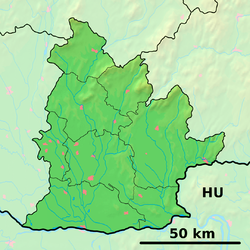
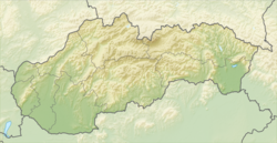
Location of Topoľčany in the Nitra Region Location of Topoľčany in Slovakia | |
| Coordinates: 48°33′N 18°11′E / 48.55°N 18.18°E | |
| Country | |
| Region | |
| District | Topoľčany District |
| First mentioned | 1173 |
| Government | |
| • Mayor | JUDr. Alexandra Gieciová |
| Area | |
| • Total | 27.58 km2 (10.65 sq mi) |
| Elevation | 187 m (614 ft) |
| Population (2021)[3] | |
| • Total | 24,086 |
| Time zone | UTC+1 (CET) |
| • Summer (DST) | UTC+2 (CEST) |
| Postal code | 955 01[2] |
| Area code | +421 38[2] |
| Car plate | TO |
| Website | www |
Topoľčany (Hungarian: Nagytapolcsány) is a town in the Nitra Region in Slovakia. About 25,000 people live there. The Nitra River flows through a valley between the two mountain ranges: Tribeč to the southeast and Považský Inovec to the northwest. It is the birthplace of the current Prime Minister of Slovakia Robert Fico.
References
[change | change source]- ↑ "Hustota obyvateľstva - obce [om7014rr_ukaz: Rozloha (Štvorcový meter)]". www.statistics.sk (in Slovak). Statistical Office of the Slovak Republic. 2022-03-31. Retrieved 2022-03-31.
- ↑ 2.0 2.1 2.2 "Základná charakteristika". www.statistics.sk (in Slovak). Statistical Office of the Slovak Republic. 2015-04-17. Retrieved 2022-03-31.
- ↑ "Počet obyvateľov podľa pohlavia - obce (ročne)". www.statistics.sk (in Slovak). Statistical Office of the Slovak Republic. 2022-03-31. Retrieved 2022-03-31.
Other websites
[change | change source]Wikimedia Commons has media related to Topoľčany.
- Official website (in Slovak)


